Studying Circadian Rhythms And Sleep In Space
Studying Circadian Rhythms and Sleep in Space
Do you remember the last time you stayed awake all night? Maybe you had a major exam, or flew across the ocean. How did you feel the following day? The time at which you would normally feel sleepy was probably different from usual. Your eyes “told” you that it was day, time for work or school. Your brain or muscles disagreed. They “told” you that it was middle of the night, and that you should sleep.

Changing when you sleep, or being in areas where daytime and nighttime are “off-schedule”, affects your circadian rhythm. The circadian rhythm exists in humans as a roughly 24-hour clock that prompts us to sleep or wake.

The European Space Agency’s experiment, Circadian Rhythms, investigates the role of this “biological clock” and its changes during spaceflight. Researchers hypothesize that a non-24-hour cycle of light and dark affects crew members’ circadian rhythms. Understanding the effects of life in space on astronauts’ circadian rhythms may help improve performance and health for future crew members.
Researchers collect data on astronaut’s circadian rhythms by using a “double-sensor,” which measures the temperature at the core of the body. The crew attaches one sensor to their head, and the other to their chest.

Based on results from this research, future crew members could more accurately adjust their sleep, work and physical activity scheduled to accommodate natural circadian cycles, which could improve productivity and health.
Make sure to follow us on Tumblr for your regular dose of space: http://nasa.tumblr.com
More Posts from Nasa and Others
More than Just Dust in the Wind

From space, we can see a swirling brown mass making its way across the Atlantic – dust from the Sahara Desert – the largest hot desert in the world. It’s a normal phenomenon. Every year, winds carry millions of tons of dust from North Africa, usually during spring and summer in the Northern Hemisphere.

June 2020 has seen a massive plume of dust crossing the ocean. It’s so large it’s visible from one million miles away in space.

Dust clouds this large can affect air quality in regions where the dust arrives. The particles can also scatter the Sun’s light, making sunrises and sunsets more vibrant.

Dust particles in the air are also known as aerosols. We can measure aerosols, including dust, sea salt and smoke, from satellites and also use computer models to study how they move with the wind.

Following the transport of dust from space shows us how one of the driest places on Earth plays a role in fertilizing the Amazon rainforest. There are minerals in Saharan dust, like phosphorous, that exist in commercial fertilizers, helping seed the rainforest.
Make sure to follow us on Tumblr for your regular dose of space: http://nasa.tumblr.com
10 Ground-breaking Earth Satellite Images from 2018
In 2018, our satellites captured beautiful imagery from throughout the solar system and beyond. However, some of our favorite visualizations are of this very planet. While this list is by no means exhaustive, it does capture some Earth satellite images from this year that are both visually striking as well as scientifically informative. This list also represents a broad variety of Earth’s features, as well as satellite instrumentation. Take a journey with our eyes in the sky!
10. Hurricane Florence

Before making landfall, Hurricane Florence churned in the Atlantic for a full two weeks — making it among the longest-lived cyclones of the 2018 season. When it finally did hit land on Sep. 14, the storm devastated the southeastern U.S. coast with intense winds, torrential rains and severe flooding.
This natural-color image was acquired by MODIS on the Terra Satellite on Sep. 12, 2018.
Images like this, as well as other satellite information, were used to anticipate the impact of the storm. Our Disasters Program created flood proxy maps that were shared with the Federal Emergency Management Agency (FEMA) and the National Guard to estimate how many and which communities would be most affected by the storm, in order to help prepare recovery efforts ahead of time.
9. Australia’s Lake Eyre Basin

The Lake Eyre Basin covers one-sixth of Australia and is one of the world’s largest internally draining river systems. However, the rivers supported by this system are ephemeral, meaning that they only run for short periods of time following unpredictable rain — the rest of the time, the Basin is a dry, arid desert.
However, when the heavy rain comes, the basin erupts in an explosion of green. In this false-color image captured by the Operational Land Imager (OLI) on Landsat 8 on Apr. 25, 2018, you can see how the vegetation completely envelops the spaces where the water has receded. (Flood water is indicated by light blue, and vegetation is indicated by light green.)
Satellites are an excellent tool for tracking greening events that are followed by flooding. These events offer opportunities for predictive tools as well as recreation.
8. Alaska’s Chukchi Sea

A Monet painting comes to life as the Chukchi Sea swirls with microscopic marine algae.
This image was captured off the Alaskan coast by OLI on Landsat 8 on Jun. 18, 2018. After the Arctic sea ice breaks up each spring, the nutrient-rich Bering Sea water mixes with the nutrient-poor Alaskan coastal water. Each type of water brings with it a different type of phytoplankton and the surface waters have just enough light for the algae to populate and flourish. The result is these mesmerizing patterns of turquoise and green.
This image represents one piece of much larger, incredibly complex ecosystem. While one would not normally associate the breaking up of sea ice with phytoplankton blooms, it is an intricate process of the phytoplankton life cycle. The size of the blooms have varied greatly from year to year, and experts are unsure why. Images like these can help scientists track the development of these blooms and link it to other environmental changes.
7. Hawaii’s Kilauea

Sometimes fresh lava is best viewed in infrared.
This false-color image of Kilauea, captured by OLI on Landsat 8 on May 23, 2018, shows the infrared signal emitted by lava flowing toward the sea. The purple areas surrounding the glowing lava are clouds lit from below, indicating that this image was taken through a break in the clouds.
The Puʻu ʻŌʻō Kupaianaha eruption has been continuously spewing red-hot lava since 1983, making it the longest eruption at Kilauea in recorded history. However, new fissures opened up this year that forced many to evacuate the area. Hawaii’s largest lake evaporated in hours and hundreds of homes were destroyed in Vacationland and Kapoho.
Imagery, seismometers and ground-based instruments were used to track the underground movement of magma. Infrared imagery can be incredibly helpful in disasters like this when you to view data that cannot be observed with the naked eye.
6. California’s Woolsey Burn Scar

Nothing quite encapsulates the destruction of a wildfire like a photo from outer space.
This image of the Woolsey Fire aftermath in Southern California was captured on Nov. 18, 2018 by the Advanced Spaceborned Thermal Emission and Reflection Radiometer (ASTER) on the Terra satellite. This false-color infrared image has been enhanced to clearly show the burned vegetation (indicated by brown) and the vegetation that survived unscathed (indicated by green).
The Woolsey Fire clearly left its mark, with almost 152 square miles (394 square km) and 88% of the Santa Monica Mountains National Recreation Area badly burned. Images like this one can assist fire managers in the area plan for recovery.
5. Bangladesh’s Padma River

As the years go by, the Padma River grows and shrinks, twists and turns. It never has a fixed shape, and as a result, thousands of people must regularly adapt to the constant changes in the river’s 75-mile (130-km) shoreline.
This image captured on Jan. 20, 2018 by OLI on Landsat 8 depicts one of the major rivers of Bangladesh. For thirty years, scientists have been tracking the erosion of the river with satellite imagery. Combinations of shortwave infrared, near infrared, and visible light are used to detect differences year-to-year in width, depth, and shape of the river. Sometimes the river splits off, but then rejoins again later. These patterns are created by the river carrying and depositing sediment, shaping the curves of the path of water.
Monitoring the Padma River is going to become especially important as a new bridge development project advances in the Char Janajat area. Although the bridge will most certainly help shorten travel times for citizens, nobody is quite sure how the river erosion might affect the construction and vice versa.
4. Alaska’s Yakutat Glacier

It’s hard to believe that Harlequin Lake was once all dry land — but it only started to form once Yakutat Glacier started melting. The lake appeared at the beginning of the twentieth century, and has been growing rapidly ever since.
In this hauntingly beautiful image, captured on Sep. 21 2018 by OLI on Landsat 8, the effect of climate change is apparent — especially when compared to earlier images of the region.
Unless the climate warming starts to reverse very soon — which scientists consider very unlikely — Yakutat could be gone as soon as 2070.
3. South Africa’s Theewaterskloof

Cape Town is a seaside city planted on the tip of South Africa. It’s a city known for its beaches and biodiversity — it also almost became known as the first major city to officially run out of water.
This image of Cape Town’s largest reservoir — Theewaterskloof — was acquired on Jul. 9th, 2018 by OLI on Landsat 8. By the time this photo was taken, the city’s main reservoirs stood at 55%. This was a huge increase from where it stood just six months earlier: just 13%.
The severe water shortage in the region started in 2015, only to become more threatening after three successive and unusually dry years. The entire city was preparing for Day Zero — the day the tap water would be shut off.
Despite forecasts that Day Zero would arrive in April, a combination of heavier rains and local conservation efforts restored the majority of the reservoir.
2. Aerosol Earth

Aerosols are all around us. From the smoke from a fire, to the dust in the wind to the salt in sea spray — these solid particles and liquid droplets are always swirling in our atmosphere, oftentimes unseen.
The Goddard Earth Observing System Forward Processing (GEOS FP) model uses mathematical equations to model what is happening in our atmosphere. The inputs for its equations — temperature, moisture, wind, etc. — come from our satellites and ground sensors.
This visualization was compiled on Aug. 24, 2018 — obviously a busy day for aerosols in our atmosphere. Swirls of sea salt (indicated by blue) reveal typhoons Soulik and Cimaron heading straight towards South Korea and Japan. A haze of black carbon (indicated by red) suffuse from agricultural burning in Africa and large wildfires in North America. And clouds of dust (indicated by purple) float off the Sahara desert.
1. Camp Fire

With nearly a hundred fatalities, hundreds of thousands of acres burned and billions of dollars of damage, the world watched in horror as Camp Fire grew to become the most destructive California wildfire in recorded history.
This image was captured on Nov. 8, 2018 by OLI on Landsat 8 on the same day Camp Fire ignited. It consolidates both visible light and shortwave-infrared light in order to highlight the active fire. Strong winds and dry conditions literally fanned the flames and spread this wildfire like a rash.
This image has not only become the iconic portrait for Camp Fire, it is also sobering representation of how quickly a fire can grow out of control in a short amount of time. Even from space, you can almost smell the massive plumes of smoke and feel the heat of the fires.
Whether you realize it or not, our Earth satellite missions are collecting data everyday in order to monitor environmental changes and prepare for natural disasters. If your interest is piqued by this list, head over to the Earth Observatory. The Earth Observatory updates daily with fresh, new content — brought to you by none other than our eyes in the sky.
Make sure to follow us on Tumblr for your regular dose of space: http://nasa.tumblr.com
Could Planets Like Those Imagined in Star Wars Be Real??
Look at what we’ve found so far.
Is your favorite Star Wars planet a desert world or an ice planet or a jungle moon?
It’s possible that your favorite planet exists right here in our galaxy. Astronomers have found over 3,400 planets around other stars, called “exoplanets.”
Some of these alien worlds could be very similar to arid Tatooine, watery Scarif and even frozen Hoth, according to NASA scientists.
Find out if your planet exists in a galaxy far, far away or all around you.
Planets With Two Suns

Were you going to the Tosche station to pick up some power converters? Hold on a minute and learn about Kepler-16b, 200 light-years from Earth. It’s the first honest-to-goodness planet ever found where you could watch two suns set like Luke. George Lucas himself even blessed its nickname ‘Tatooine.’ It’s not a perfect comparison: Kepler-16b is a cold gas giant roughly the size of Saturn. But don’t worry, kid.

The best part is that Tatooine aka Kepler-16b was just the first. It has family. A LOT of family. Half the stars in our galaxy are pairs, rather than single stars like our sun. If every star has at least one planet, that’s billions of worlds with two suns. Billions! Maybe waiting for life to be found on them.
Desert Worlds

If you’re like Finn and want to know why everyone wants to go back to Jakku desert planets, get this: Star Wars may be reflecting the real universe. Desert worlds are not only a very real possibility, but we think they are probably very common. They can be hot, like the fictional Tatooine and Jakku, or cold, like Jedha in “Rogue One” or our real planet Mars.
Perhaps it’s not so weird that both Luke and Rey grew up on planets that look suspiciously like each other. If you’re scouring the universe for a place to settle, you have a good chance of finding a desert planet.
Ice Planets

There is a Hoth in our galaxy! Though not the same Hoth from “The Empire Strikes Back” (no invading Imperials, for one). The icy super-Earth reminded scientists so much of the frozen Rebel base they nicknamed it “Hoth.” The planet’s real name is OGLE 2005-BLG-390L.
Our galaxy’s Hoth is too cold to support life as we know it. But life may evolve under the ice of a different world, or a moon in our solar system.
We’re currently designing a mission to look for life under the crust of Jupiter’s icy moon Europa. We’re pretty sure ity won’t look like tauntauns, if it exists.

Forest worlds

Both the forest moon of Endor and Takodana, the home of Han Solo’s favorite cantina in “Force Awakens,” are green like our home planet. But astrobiologists think that plant life on other worlds could be red, black, or even rainbow-colored!
In August 2016, astronomers from the European Southern Observatory announced the discovery of Proxima Centauri b, a planet only four light-years away from Earth, which orbits a tiny red star.

The light from a red star, also known as an M dwarf, is dim and mostly in the infrared spectrum (as opposed to the visible spectrum we see with our sun). And that could mean plants with wildly different colors than what we’re used to seeing on Earth. Or, animals that see in the near-infrared.
And Beyond

The next few years will see the launch of a new generation of spacecraft to search for planets around other stars. TESS and the James Webb Telescope will go into space in 2018, and WFIRST in the mid-2020s. That’s one step closer to finding life.
You don’t need to visit a galaxy far, far away to find wondrous worlds. Just visit this one ... there’s plenty to see.
Discover more about exoplanets here: https://exoplanets.nasa.gov/
Make sure to follow us on Tumblr for your regular dose of space: http://nasa.tumblr.com

For Earth Day, we’re inviting you to take a moment to celebrate our wonderful water world, Earth. As far as we know, our Blue Marble is the only place in the universe with life, and that life depends on water. Snap a photo of yourself outside and tag it #GlobalSelfie – bonus points if your selfie features your favorite body of water! http://go.nasa.gov/3xFt0H0
Make sure to follow us on Tumblr for your regular dose of space!
Diving into New Magnetic Territory with the MMS Mission
Our Magnetospheric Multiscale Mission, or MMS, is on a journey to study a new region of space.

On May 4, 2017, after three months of precisely coordinated maneuvers, MMS reached its new orbit to begin studying the magnetic environment on the ever-rotating nighttime side of Earth.

The space around Earth is not as empty as it looks. It’s packed with high energy electrons and ions that zoom along magnetic field lines and surf along waves created by electric and magnetic fields.

MMS studies how these particles move in order to understand a process known as magnetic reconnection, which occurs when magnetic fields explosively collide and re-align.

After launch, MMS started exploring the magnetic environment on the side of Earth closest to the sun. Now, MMS has been boosted into a new orbit that tops out twice as high as before, at over 98,000 miles above Earth’s surface.
The new orbit will allow the spacecraft to study magnetic reconnection on the night side of Earth, where the process is thought to cause the northern and southern lights and energize particles that fill the radiation belts, a doughnut-shaped region of trapped particles surrounding Earth.

MMS uses four separate but identical spacecraft, which fly in a tight pyramid formation known as a tetrahedron. This allows MMS to map the magnetic environment in three dimensions.

MMS made many discoveries during its first two years in space, and its new orbit will open the door to even more. The information scientists get from MMS will help us better understand our space environment, which helps in planning future missions to explore even further beyond our planet. Learn more about MMS at nasa.gov/mms.
Make sure to follow us on Tumblr for your regular dose of space: http://nasa.tumblr.com
Solar System: Things to Know This Week
We love Lucy—our spacecraft that will visit the ancient Trojan asteroids near Jupiter, that is. This week, let us count the ways this 2021 mission could revolutionize what we know about the origins of Earth and ourselves.
1. Lucky Lucy

Earlier this year, we selected the Lucy mission to make the first-ever visit to a group of asteroids known as the Trojans. This swarm of asteroids orbits in two loose groups around the Sun, with one group always ahead of Jupiter in its path, and the other always behind. The bodies are stabilized by the Sun and Jupiter in a gravitational balancing act, gathering in locations known as Lagrange points.
2. Old. Really, Really Old

Jupiter's swarms of Trojan asteroids may be remnants of the material that formed our outer planets more than 4 billion years ago—so these fossils may help reveal our most distant origins. "They hold vital clues to deciphering the history of the solar system," said Dr. Harold F. Levison, Lucy principal investigator from Southwest Research Institute (SwRI) in Boulder, Colorado.
3. A Link to The Beatles

Lucy takes its name from the fossilized human ancestor, called "Lucy" by her discoverers, whose skeleton provided unique insight into humanity's evolution. On the night it was discovered in 1974, the team's celebration included dancing and singing to The Beatles' song "Lucy In The Sky With Diamonds." At some point during that evening, expedition member Pamela Alderman named the skeleton "Lucy," and the name stuck. Jump ahead to 2013 and the mission's principal investigator, Dr. Levison, was inspired by that link to our beginnings to name the spacecraft after Lucy the fossil. The connection to The Beatles' song was just icing on the cake.
4. Travel Itinerary
One of two missions selected in a highly competitive process, Lucy will launch in October 2021. With boosts from Earth's gravity, it will complete a 12-year journey to seven different asteroids: a Main Belt asteroid and six Trojans.
5. Making History

No other space mission in history has been launched to as many different destinations in independent orbits around the Sun. Lucy will show us, for the first time, the diversity of the primordial bodies that built the planets.
6. What Lies Beneath
Lucy's complex path will take it to both clusters of Trojans and give us our first close-up view of all three major types of bodies in the swarms (so-called C-, P- and D-types). The dark-red P- and D-type Trojans resemble those found in the Kuiper Belt of icy bodies that extends beyond the orbit of Neptune. The C-types are found mostly in the outer parts of the Main Belt of asteroids, between the orbits of Mars and Jupiter. All of the Trojans are thought to be abundant in dark carbon compounds. Below an insulating blanket of dust, they are probably rich in water and other volatile substances.
7. Pretzel, Anyone?

This diagram illustrates Lucy's orbital path. The spacecraft's path (green) is shown in a slowly turning frame of reference that makes Jupiter appear stationary, giving the trajectory its pretzel-like shape.
8. Moving Targets

This time-lapsed animation shows the movements of the inner planets (Mercury, brown; Venus, white; Earth, blue; Mars, red), Jupiter (orange), and the two Trojan swarms (green) during the course of the Lucy mission.
9. Long To-Do List
Lucy and its impressive suite of remote-sensing instruments will study the geology, surface composition, and physical properties of the Trojans at close range. The payload includes three imaging and mapping instruments, including a color imaging and infrared mapping spectrometer and a thermal infrared spectrometer. Lucy also will perform radio science investigations using its telecommunications system to determine the masses and densities of the Trojan targets.
10. Dream Team
Several institutions will come together to successfully pull off this mission. The Southwest Research Institute in Boulder, Colorado, is the principal investigator institution. Our Goddard Space Flight Center will provide overall mission management, systems engineering, and safety and mission assurance. Lockheed Martin Space Systems in Denver will build the spacecraft. Instruments will be provided by Goddard, the Johns Hopkins Applied Physics Laboratory and Arizona State University. Discovery missions are overseen by the Planetary Missions Program Office at our Marshall Space Flight Center in Huntsville, Alabama, for our Planetary Science Division.
Make sure to follow us on Tumblr for your regular dose of space: http://nasa.tumblr.com
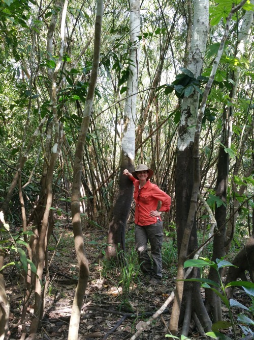
NASA Spotlight: Carbon Cycle and Ecosystems Earth Scientist Erika Podest
Dr. Erika Podest is a scientist with the Carbon Cycle and Ecosystems Group in our Jet Propulsion Laboratory’s Earth Science Division and Visiting Associate Researcher in the Joint Institute for Regional Earth System Science and Engineering (JIFRESSE) at UCLA. Her research entails using satellite images to study Earth’s ecosystems specifically related to wetlands and boreal forests and how they are being affected by climate change.
Erika took time from studying our home planet to answer questions about her life and career! Get to know our Earth Scientist:
What inspires/motivates you?
I am inspired by the beauty of nature, its perfection and by the peace it brings me. My motivation is to make a positive impact on our planet by better understanding it and caring for it.
What first sparked your interest in Earth science?
I was born and raised in Panama, which is a country with an exuberant nature. Since I can remember, I was always surrounded by nature because my father was an adventurer who loved the outdoors and always took me with him to go exploring or simply to enjoy a nice relaxing day outside. This led me to develop a deep sense of appreciation, respect, and curiosity for nature, which sparked my interest to learn about it and pursue a career in Earth Science.
What got you interested in the study of Earth from space?

Early in my college years I was training for my private pilot’s license and during my solo flights I would take pictures of features on the surface from the plane. I was always amazed at the details the pictures showed of the landscape that were not obvious from the ground. This was the first step towards discovering that there was a field for studying Earth from above, called remote sensing and consequently my Masters and Ph.D. were focused in this field.
What technology, discovery, or policy do you think has the most potential to decrease humans’ environmental impact (e.g. wind turbines, carbon taxes, clean meat)?
I don’t think it is a matter of any one technology, discovery or policy. It is a combination of everything. Having an impact on climate change involves every level and direction, from the bottom up at the individual, grassroots and community level to the top down at the policy level. As individuals, I think it is important to educate ourselves about climate change (I suggest climate.nasa.gov). We all have the power to make a positive change by speaking up and making informed decisions about our consumptive habits.
What’s a fact about the role of wetlands and boreal forests in the global ecosystem that you think would surprise people?

Wetlands provide a vital role in carbon storage. Even though they cover about 5-8% of the Earth’s land surface, studies indicate that they contain a disproportionate amount of our planet’s total soil carbon, about 20-30%. In addition, they are like the arteries and veins of the landscape, acting as water sources and purifiers and helping in flood control. They also protect our shores and harbor large amounts of biodiversity.
Boreal forests are found in the uppermost northern hemisphere (Alaska, most of Canada, Russia, Scandinavia and northern Asia) and account for about 30% of the world’s forest cover. These forests lock up enormous amounts of carbon and help slow the increasing buildup of carbon dioxide in our atmosphere. In their peak growth phase during the northern spring and summer, the worldwide levels of carbon dioxide fall and the worldwide levels of oxygen rise.
Can you describe a typical day on a research trip?

It depends on the research trip. For example, one of my more recent ones was to the Peruvian Amazon where we went upriver on a boat for three weeks on a major tributary of the Amazon River called the Ucuyali River. I was with a team of eight researchers and we were studying the wetland ecosystems of the Pacaya-Samiria Natural Reserve, which entailed making vegetation measurements and assessing inundation extent to validate our scientific findings from satellite observations. We camped for most of the trip and a typical day entailed waking up at around 5:00 am with a symphony of sounds that emerged from the forest, including monkeys. We had breakfast and set off from base camp into the forest (~1 hour walk) to work an 8-9 hour day with a short lunch break (we had packed lunches) at noon. At the end of the day I’d be drenched in sweat, sunscreen, insect repellent, and dust and I’d bathe with water from the river, which was as brown as a milk chocolate bar. It was the most refreshing and cleansing feeling! The day would close with dinner followed with a discussion of the measurements to be collected the following day. Lights were out by 7:30 pm (which seemed like midnight) and I’d re-emerge myself into my tent in the dark tropical night surrounded by the sounds of the forest, until the next morning.
What are some of the most important lessons you’ve learned in life?
That it is important to be patient, humble and thankful.
Do you have any secret skills, talents, or hobbies?
Great question! I do not have any secrete skills or talents but I do have a couple of hobbies. I play the piano, though I am still a novice. I love windsurfing. It is an amazing feeling to skim over the water at fast speeds (I’m also an adrenaline junkie). Finally, I am fascinated by magic card tricks and whenever I have some free time I like to learn a new trick.
What do you enjoy the most about your job?
I enjoy constantly learning about our natural world and how it works. I also really enjoy communicating my work to students and to the general public. I find it especially rewarding when I can educate people and motivate students to consider careers in science.
Erika, thank you for your time and everything you do to keep our home planet safe!
Make sure to follow us on Tumblr for your regular dose of space: http://nasa.tumblr.com.
10 Questions About the 2017 Astronaut Class
We will select between eight and 14 new astronaut candidates from among a record-breaking applicant class of more than 18,300, almost three times the number of applications the agency received in 2012 for the recent astronaut class, and far surpassing the previous record of 8,000 in 1978.

The candidates will be announced at an event at our Johnson Space Center in Houston, Texas at 2 p.m. EDT on June 7. You can find more information on how to watch the announcement HERE.
1. What are the qualifications for becoming an astronaut?

Applicants must meet the following minimum requirements before submitting an application.
Bachelor’s degree from an accredited institution in engineering, biological science, physical science, computer science or mathematics.
Degree must be followed by at least 3 years of related, progressively responsible, professional experience or at least 1,000 hours of pilot-in-command time in jet aircraft
Ability to pass the NASA Astronaut physical.
For more information, visit: https://astronauts.nasa.gov/content/faq.htm
2. What have selections looked like in the past?

There have been 22 classes of astronauts selected from the original “Mercury Seven” in 1959 to the most recent 2017 class. Other notable classes include:
The fourth class in 1965 known as “The Scientists: because academic experience was favored over pilot skills.
The eighth class in 1978 was a huge step forward for diversity, featuring the first female, African American and Asian American selections.
The 16th class in 1996 was the largest class yet with 44 members – 35 U.S. astronauts and 9 international astronauts. They were selected for the frequent Space Shuttle flights and the anticipated need for International Space Station crewmembers.
The 21st class in 2013 was the first class to have 50/50 gender split with 4 female members and 4 male members.
3. What vehicles will they fly in?

They could be assigned on any of four different spacecraft: the International Space Station, our Orion spacecraft for deep space exploration or one of two American-made commercial crew spacecraft currently in development – Boeing’s CST-199 Starliner or the SpaceX Crew Dragon.
4. Where will they go?

These astronauts will be part of expanded crews aboard the space station that will significantly increase the crew time available to conduct the important research and technology demonstrations that are advancing our knowledge for missions farther into space than humans have gone before, while also returning benefits to Earth. They will also be candidates for missions beyond the moon and into deep space aboard our Orion spacecraft on flights that help pave the way for missions to Mars.
5. What will their roles be?

After completing two years of general training, these astronaut candidates will be considered full astronauts, eligible to be assigned spaceflight missions. While they wait for their turn, they will be given duties within the Astronaut Office at Johnson Space Center. Technical duties can range from supporting current missions in roles such as CAPCOM in Mission Control, to advising on the development of future spacecraft.
6. What will their training look like?

The first two years of astronaut candidate training will focus on the basic skills astronauts need. They’ll practice for spacewalks in Johnson’s 60-foot deep swimming pool, the Neutral Buoyancy Lab, which requires SCUBA certification. They’ll also simulate bringing visiting spacecraft in for a berthing to the space station using its robotic arm, Canadarm2, master the ins and outs of space station system and learn Russian.

And, whether they have previous experience piloting an aircraft of not, they’ll learn to fly our fleet of T-38s. In addition, they’ll perfect their expeditionary skills, such as leadership and fellowship, through activities like survival training and geology treks.
7. What kinds of partners will they work with?

They will join a team that supports missions going on at many different NASA centers across the country, but they’ll also interact with commercial partners developing spaceflight hardware. In addition, they will work with our international partners around the globe: ESA (the European Space Agency, the Canadian Space Agency, the Japan Aerospace Exploration Agency and the Russian space agency, Roscosmos.
8. How does the selection process work?

All 18,353 of the applications submitted were reviewed by human resources experts to determine if they met the basic qualifications. Those that did were then each reviewed by a panel of about 50 people, made up primarily of current astronauts. Called the Astronaut Rating Panel, that group narrowed to applicants down to a few hundred of what they considered the most highly qualified individuals, whose references were then checked.

From that point, a smaller group called the Astronaut Selection Board brought in the top 120 applicants for an intense round of interviews and some initial medical screening tests. That group is further culled to the top 50 applicants afterward, who are brought back for a second round of interviews and additional screening. The final candidates are selected from that group.
9. How do they get notified?

Each applicant selected to become an astronaut receives a phone call from the head of the Flight Operations Directorate at our Johnson Space Center and the chief of the astronaut office. They’re asked to share the good news with only their immediate family until their selection has been officially announced.
10. How does the on boarding process work?

Astronaut candidates will report for duty at Johnson Space Center in August 2017, newly fitted flight suits in tow, and be sworn into civil service. Between their selection and their report for duty, they will make arrangements to leave their current positions and relocate with their family to Houston, Texas.
Make sure to follow us on Tumblr for your regular dose of space: http://nasa.tumblr.com
Chemical Space Gardens
You know that colorful crystal garden you grew as a kid?
Yeah, we do that in space now.
Chemical Gardens, a new investigation aboard the International Space Station takes a classic science experiment to space with the hope of improving our understanding of gravity’s impact on their structural formation.

Here on Earth, chemical gardens are most often used to teach students about things like chemical reactions.

Chemical gardens form when dissolvable metal salts are placed in an aqueous solution containing anions such as silicate, borate, phosphate, or carbonate.

Delivered to the space station aboard SpaceX’S CRS-15 cargo mission, the samples for this experiment will be processed by crew members and grown throughout Expedition 56 before returning to Earth.

Results from this investigation could provide a better understanding of cement science and improvements to biomaterial devices used for scaffolding, for use both in space and on Earth.
Follow the growth of the chemical garden and the hundreds of other investigations constantly orbiting above you by following @ISS_Research on Twitter.
Make sure to follow us on Tumblr for your regular dose of space: http://nasa.tumblr.com
A room with Earth views! 🌎 Earlier this week, astronaut Ricky Arnold captured this spectacular view of our home planet while he was orbiting at a speed of 17,500 miles per hour. If you’re wondering where in the world this video was taken, it starts as the International Space Station is above San Francisco and moving southward through the Americas.
Each day, the station completes 16 orbits of our home planet as the six humans living and working aboard our orbiting laboratory conduct important science and research. Their work will not only benefit life here on Earth, but will help us venture deeper into space than ever before.
Make sure to follow us on Tumblr for your regular dose of space: http://nasa.tumblr.com
-
 maitysubrata-blog liked this · 5 years ago
 -
 zyex liked this · 7 years ago
 -
 imperialcrystalgirl liked this · 7 years ago
 -
 isang--mag-aaral liked this · 7 years ago
 -
 fuzzy-wombat liked this · 7 years ago
 -
 nemoofoz-blog reblogged this · 7 years ago
 -
 illuminationsandghosts-blog liked this · 7 years ago
 -
 anaadelainnerstar reblogged this · 8 years ago
 -
anaadelainnerstar liked this · 8 years ago
-
 saifulnaim94-blog liked this · 8 years ago
 -
 best-hotels-posts reblogged this · 8 years ago
 -
 diabaliful reblogged this · 8 years ago
 -
 shorgelis-blog liked this · 8 years ago
 -
 chalkrevelations reblogged this · 8 years ago
 -
 thingsmydadmightlike-blog reblogged this · 8 years ago
 -
 hogwarts-starship liked this · 8 years ago
 -
 manateemilk liked this · 8 years ago
 -
 macrobbo liked this · 8 years ago
 -
 starhasarrived reblogged this · 8 years ago
 -
starhasarrived liked this · 8 years ago
-
 trafal-gurl-blog liked this · 8 years ago
 -
 sokilokii reblogged this · 8 years ago
 -
 lookinggformylostprince reblogged this · 8 years ago
 -
 wotcher-harper liked this · 8 years ago
 -
 annalindastarhederer reblogged this · 8 years ago
 -
annalindastarhederer liked this · 8 years ago
-
 trivialarmor liked this · 8 years ago
 -
 pusantheamazonian reblogged this · 8 years ago
 -
 chaoswithaface-blog liked this · 8 years ago
 -
 redcurlycrazyhair liked this · 8 years ago
 -
 eugepaprika liked this · 8 years ago
 -
 kupolisci liked this · 8 years ago
 -
 soitgoestan-blog liked this · 8 years ago
 -
 classic-goal liked this · 8 years ago
 -
 busserdinda reblogged this · 8 years ago
 -
 dindabusser liked this · 8 years ago
 -
riderbk liked this · 8 years ago
-
 distinguishedcheesecakeengineer liked this · 8 years ago
 -
 politicalmovement-blog liked this · 8 years ago
 -
 sixthrangerknight reblogged this · 8 years ago
Explore the universe and discover our home planet with the official NASA Tumblr account
1K posts